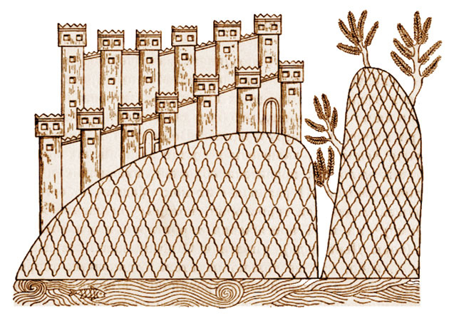
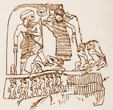
 A tower in Manna. Late VII century B.C
 by Karim K. Shukurov
In the previous issue of our magazine (March-April 2010), we presented Section I of the project “Azerbaijani history: from ancient times to the present day” by Doctor of Historical Sciences Karim Sukurov. In this issue, we continue this project with Section II. The bibliography for this paper will be given at the end of the project.
First state unions. The state of Manna. The Scythian kingdom. (3rd millennium BC – early 6th century BC)
The process of state formation. Consequences of the geopolitical situation. The Urmia area as a centre of civilization. First state unions: Aratta, Lullubi, Kuti. The state of Manna. The Scythian kingdom. The Kur-Araz culture and later.
The process of state formation
The populations of early primitive communities were people of the world or a region rather than being identified ethnically.
Socio-economic processes taking place within the primitive population gradually paved the way for the formation of distinct ethnic groupings.
 Silver plate, Zivye, Manna, VII century B.C
 It has been proven anthropologically that the most ancient population of Azerbaijan (i.e. during the Gobustan period) is the same as the population in all subsequent periods. This means that: a) the Azerbaijani population is aboriginal, meaning it is native; b) although incoming ethnic groups intermingled they did radically change its composition; c) the local population created the state; d) present-day Azerbaijanis are heirs to the states that succeeded those originally established here, down to the present day.
Consequences of the geopolitical situation
That Azerbaijan has spanned an extensive period of history and covered a wide geographical area is revealed by the historical processes which took place in this land. The geographical proximity of the southern part of Azerbaijan to Mesopotamia, which was a centre of world culture, and the ties between them, had a certain impact on political life. Towards the north, the political impact was weaker. Thus, the first ethno-political unions began to take shape in Azerbaijan’s south - around Lake Urmia.
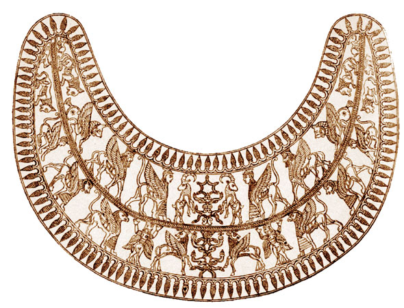 Golden pectoral, Zivye, VII century B.C
 Lake Urmia is located at an altitude of 1,275m. It is 140 km long, 40 km wide, with an area of 5,800 sq. km. At its deepest it goes down 15m. Its water is salty. The rivers Aji, Jeketu and others flow into the lake. The natural and geographical conditions there had a crucial effect on the life and economic activity of the population.
The significance of Urmia also caused it to be documented in historical sources. The first written information about the area dates to the 2nd half of the 3rd millennium BC.
Archaeological sites in Urmia (Goytepe, west of the lake; Hasanli, southeast of it etc) also speak of a rich culture there.
First state unions
Aratta (first half of the 3rd millennium BC). This was located south and southeast of Lake Urmia. It had a ruler with the status of Ensi and an appropriate bureaucratic apparatus. Sources note relations between the Aratta ruler, En-Sukushsiranna, and the Uruk (a city-state in Mesopotamia, 30th-3rd centuries BC) ruler En-Merkar (28th century - early 27th century BC). The rulers tried to subdue each other. However, when an Uruk ruler faced a difficult situation he asked Aratta for help.
Sumer (a historical province in southern Mesopotamia) cuneiform writing was known to Aratta.
 Rock relief of Lulubi king of Anubani, second half of the III millennium B.C
 Lullubi. This state union was formed in the 23rd century BC. It was located south of Lake Urmia and west of historical Aratta. Satuni (2230-2200 BC), Immashgun (2200-2170 BC) and Anubanini (2170-2150 BC) are known to have been rulers here. King Anubanini was the most famous. This is clear from his “Stone column” monument: “[An]nubanini, mighty king, king of Lulubum, had an image of himself and an image of the goddess Ishtar (goddess of prosperity and love – K. S. note) placed on Mount Batir”. In Anubanini’s time, the boundaries of his domain covered the middle course of the River Diyala in the south and Lake Urmia in the north. The Lullubi state union collapsed in the 2nd millennium BC.
Kuti. The state was formed in the 2nd half of the 3rd millennium BC, west and southwest of Lake Urmia. Of great interest is the history of the struggle between the Kuti and Akkad (a city-state in Mesopotamia, 24th-22nd centuries BC) and of the Kuti’s accession to power there. The supreme judge of the Kuti, Enridavazir, seized the kingdom of Akkad in 2200 BC and adopted the title of king. Although the Akkadians regained power, this did not last long; the Kuti took over again and this time they held on for up to 70 years. The last Kuti ruler, Tirikan, was defeated in 2109 BC, after 40 days in power and this brought an end to Kuti rule in Akkad. The Kuti who returned were oppressed by the Lullus. The fall of the Lullubi and Kuti state unions brought single political unions to an end.
 King of Kuti. III millennium B.C
 The shaking of the rule of Aratta, Lullubi and Kuti, who had been the earliest to embark upon political organization, caused other ethnic groups that were part of these unions to become more active. The Turukki and Su detached themselves from the unions. In order to eliminate the threat of the Turukki, Assyria (a state in the land of present-day Iraq, 2nd millennium BC – 605 BC) organized military campaigns. The Turukki acted in union with the Lullubi, Kuti and other tribes. This union undermined Assyrian power. Babylon (a state in southern Mesopotamia, early 2nd millennium BC – 539 BC) began to rise in significance. The famous Babylon ruler Hammurapi (1792-1750 BC) organized a march against these tribes.
As Assyria regained strength under King Adadnerari I (1307-1275 BC), its policy of occupation also expanded. Cuneiform sources particularly refer to this: of the Assyrian rulers, Salmanasar I (1274-1245 BC), Tukulti–Ninurta I (1244–1208 BC) and others continued this process. During the struggle against Assyria, new political unions began to form, centralising in the state of Manna.
The state of Manna
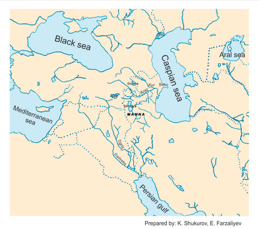
This state was located on the lands between the upper courses of the rivers Diyala and Little Zab in the south, the Caspian Sea in the east, the River Araz in the north and Lake Urmia in the West.
Its capital was the city of Izirtu (Zirta; its remains are on Kaplantu hill near Zawiyah).
Its known rulers are Udaki (820s BC), Iranzu (740-719 BC), Aza (718-716 BC), Ullusu (716-680 BC), Ahsheri (680-650 BC) and Ualli (650-630).
Zamua, Nikdiara’s “country”, Allabria, Karalla, Gilzan and other small political structures appeared in southern Azerbaijan. The kingdom of Manna strengthened towards the middle of the 9th century BC.
Manna’s name is mentioned for the first time in an inscription made by the Assyrian king Salmanasar III in connection with events in the year 843 BC. Manna seized power over political unions that had formed around Lake Urmia.
 Golden bracelet, Zivye, VII century B.C
 Manna’s position consolidated further. Under Ahsheri, the state increased its might and was able to expand its territory considerably. This antagonised Assyria and, in 660 BC, it defeated Manna and made it a vassal state. With this, enmity with Media increased and Manna’s subjection was ended. Manna’s name was mentioned for the last time in the Bible, in connection with events in the year 593 BC.
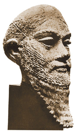
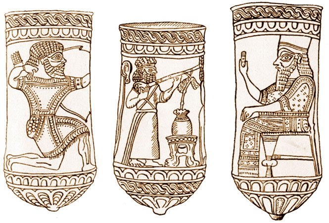 Manna archer, VII century B.C; Manna musician, VII century B.C; Manna King, VII century B.C
 Manna had its own script.
In the final years of Manna’s existence, the Scythian kingdom appeared on the territory of Azerbaijan.
The Scythian kingdom
The kingdom of the Scythians was located on the lands between the middle course of the River Kur and Manna (near Lake Urmia).
The Scythians arrived on the coast of the northern Black Sea in the 2nd half of the 8th century BC and ousted the Cimmerians who were living there. Later, they arrived in West Asia and established a “kingdom” there. Along with the names of Urartu, Manna and Media, the name of the Scythian kingdom is also mentioned in the Bible in reference to events in the year 693 BC.
The Scythians, the Cimmerians, who had arrived before them and the Sakas, who were part of the Scythians, also settled on Azerbaijani territory. A “kingdom” began to take shape in the 670s BC. This was not a classical kingdom, it was a political structure governed by the ruling Scythian dynasty, which was dependent on military forces.
The known Scythians rulers were Ishpakay, Partatuta, Tugdamme (Lygdamis in Greek) and Madi.
The Scythians were historically very significant. The Mada managed to resist the Scythians and took over the territory of the kingdom in the early 6th century BC.
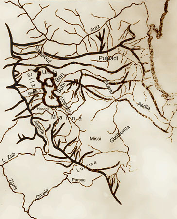 Schematic map of Urmia and surrounding area
 At a time when the south of Azerbaijan was an arena for tense political developments and change, there were also particular tendencies in the north. They were primarily apparent in the Kur-Araz culture, which covered a single, large geographical area, living out its final stages and disintegrating. Unlike Azerbaijan’s south, the names of tribes living in the north were not recorded in written sources.
According to archaeological periodification, the new situation that emerged as a result of the decline of the Kur-Araz culture is referred to as the Middle Bronze Age (approximately the last quarter of the 3rd millennium BC – the middle of the 2nd millennium BC). The Middle Bronze Age has been studied at Kultepe I and II (Nakhchivan), Uzarliktepe and Garakopaktepe (Karabakh) and other sites in Azerbaijan’s north.
Advances made during the Kur-Araz culture expanded the development of urban areas. Thus, Uzarliktepe and Goytepe covered 3 hectares, Chinartepe – 7 ha, Kultepe II – 10 ha, and Oglanqala – 40 ha. These and other urban settlements had defensive walls with towers. The design of cities was also improving. The construction of rectangular buildings became the prominent architecture. Features of West Asian town-planning are clearly indicated here.
In the Middle Bronze Age, the traditional spheres of agriculture (tillage, cattle-breeding etc.) continued to develop. The main change took place in craftsmanship. This became an independent sphere of employment. Pottery became more widespread. Special pottery zones were formed in cities and earthenware utensils were both practical and tastefully decorated. It is no coincidence that the Middle Bronze Age is also called the “culture of painted earthenware”.
In this period there were also changes in metal manufacture and metal processing. This included the making of various items by casting, soldering etc.
Studies of Middle Bronze Age settlements, including gravestones, show that political relations were being formed in Azerbaijan’s north. However, since there is no written information, it is not possible to restore a full picture of these processes.
 Ancient Azerbaijan, III millennium B.C – early VII century - showing modern borders
 Thus the archaeological materials available enable us to say that, as in Azerbaijan’s south, so in the north: economic life and ethno-political processes developed significantly. However, these processes were not sufficiently advanced for the full establishment of states. It seems that these processes contributed to the strengthening of economic and cultural ties between the south and the north of Azerbaijan and to their transformation into a single political-geographical area. Otherwise, because of the presence of powerful political unions in the north, there could have been major conflicts and clashes.