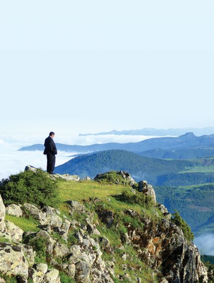
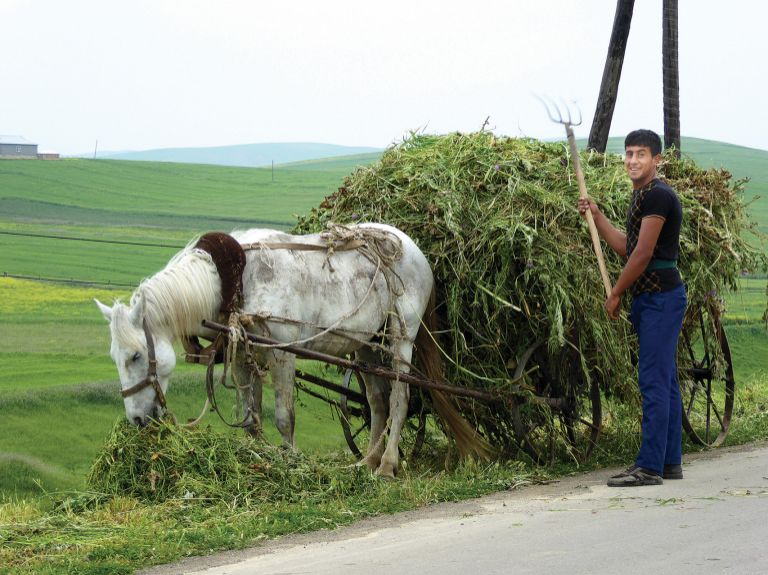
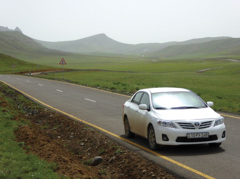


The Talysh Mountains of southern Azerbaijan are full of astoundingly friendly, hospitable characters and landscapes that rise from citrus and tea groves through grand woodlands to upland fields and sheep grazed hilltops and mountain crags. For years the streamside woodlands of the Lenkeren-Lerik and Masalli-Yardimli roads have been popular weekender getaways but the terrible state of virtually all other regional roads had discouraged visitors from getting further into the wilderness. Recently much has changed. A flurry of road building in 2014-15 has added several exciting new options for reaching some remote, previously inaccessible corners, thereby adding a whole lot more appeal to the idea of heading south. Mark Elliott explores five newly accessible routes to compare their charms:
Jalilabad-Kovozbulaq-Shatirli
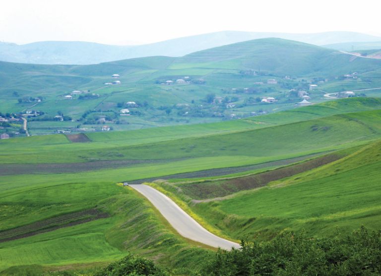
At the western end of Jalilabad town, just as the main road appears to be petering out, take a right turn near the fire station and a leap of faith. Before you know it the unpromising lane has turned into a brand new asphalt road that takes a wide arc roller-coastering up and over a whole series of bucolic hills and passing through a dozen or so agricultural villages. The continual rise and fall makes for a constantly changing panorama with nothing to block your view but the next hill. The result is a landscape somewhat like southern England’s South Downs but at double scale.

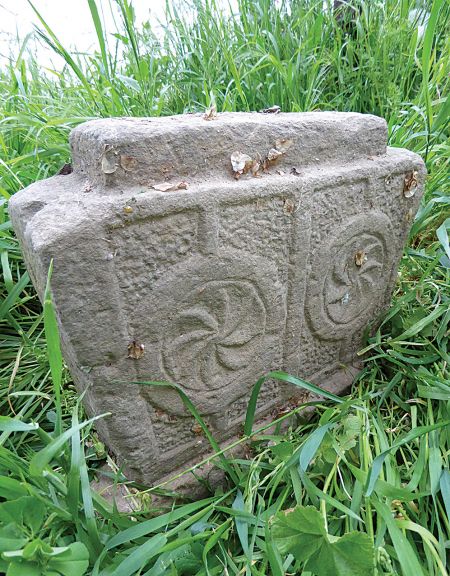
A scattering of older tile-roofed houses add interest to the occasional villages. The whole route has a wonderful feeling of openness. There’s no really visual climax to the journey but for keen archaeologists, the place to head for would be the charming village of Shatirli where the headmaster Elchin Amanov has amassed a great collection of ancient archaeological finds. However, after Kovuz Bulaq, where the asphalt ends, the still easily driveable road passes right beside the inner border fence. This proximity to Iran can cause trouble with the army and you certainly shouldn’t take any photos that include the fence.
| Views *** – Always lovely, but after a while one view seems much like the last Accommodation & Food * – There’s no formal accommodation whatever after Jalilabad and barely any shops. Bring supplies. Asphalt **** – Mostly great before Kovuzbulaq albeit with some sudden unexpected bumps. Unpaved but well graded after Kovuz Bulaq |
Masalli-Yardimli-Arvana (plus Pirembel & Abbasabad)
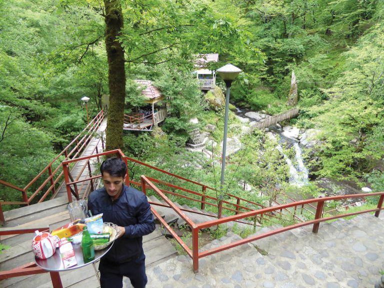
The Masalli-Yardimli section of this road has been surfaced for years with the ‘old’ section making accessible a hot springs area, fire-river, waterfall and selection of rustic family getaways. However, what’s changed is that going beyond Yardimli is no longer limited to a painful 4WD endurance test. Till recently, reaching Arvana was about as difficult as reaching Nirvana. Now it’s smooth running all the way, though be careful not to stop at Deman where you briefly run right alongside the Iranian border fence. To be sure that your presence here doesn’t raise the wrong sort of suspicions, it’s worth popping into Yardimli town hall and mentioning your plans to the authorities.
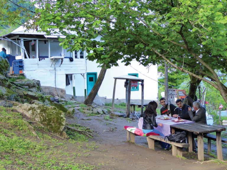
Arvana does have a certain end-of-the-world intrigue and a very distant horizon view of Allar’s fortress crag, but you might prefer to stop short of the more sensitive section and visit historic Pirembel. That’s an attractive village filled with quince and nut trees, high up a steep sided amphitheatre with some exposed sections of reddish cliff. Asphalt ends where the central tree-shaded Nargozbulagi spring pours cold mineral water through a Soviet era mosaic between mossy rocks. The recently rebuilt mosque is 1km above by a switchback muddy track. It’s an impressive creation with Central Asian style majolica tile frontage and a mirror-faceted interior. Its sponsor, a Moscow-based Pirembel native, has also built an unexpected and totally unadvertised 5-room hotel (050-5875821, double room at 50 AZN, wifi, open May-mid-Oct) in the garden of his grand house, 400m above the mosque. They have a couple of quad bikes to rent and can organise horses.
For some of the most sweeping views in the region there is an altogether different and even shorter detour from Yardimli, crossing the river in the upper part of town then taking the Abbasabad road – after winding up 3km you’re on a lovely ridge top road.
| Views **** - You’re into woodlands quicker than on the Lerik route and also quicker into grassy steep-sloped valleys which the road contours through, often high above the river. After Deman there are amazingly wide views of high upland grasslands which turn very dry later in the year. Accommodation & Food **** - Lots of choice in the first 16km, then just three options but all are good in their way. Asphalt ***** - Impeccable asphalt all the way to Arvana, Pirembel and Abbasabad. Very limited traffic makes this road an absolute joy. |
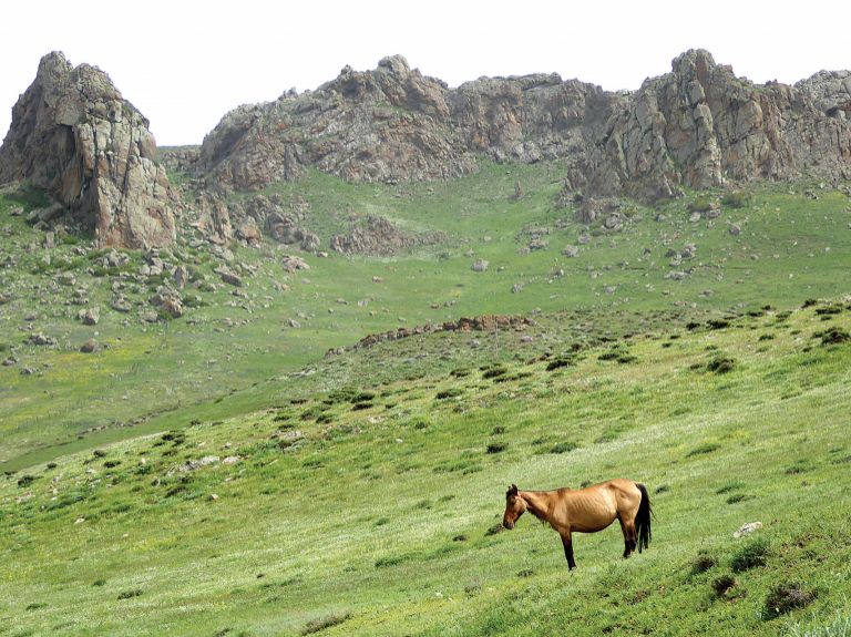
Lenkeran-Lerik-Kelvez (plus Shingadulan)
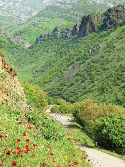
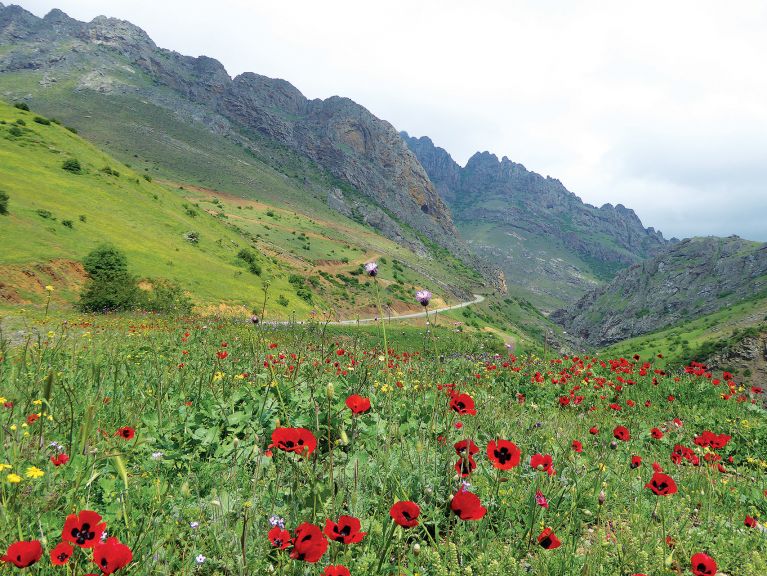
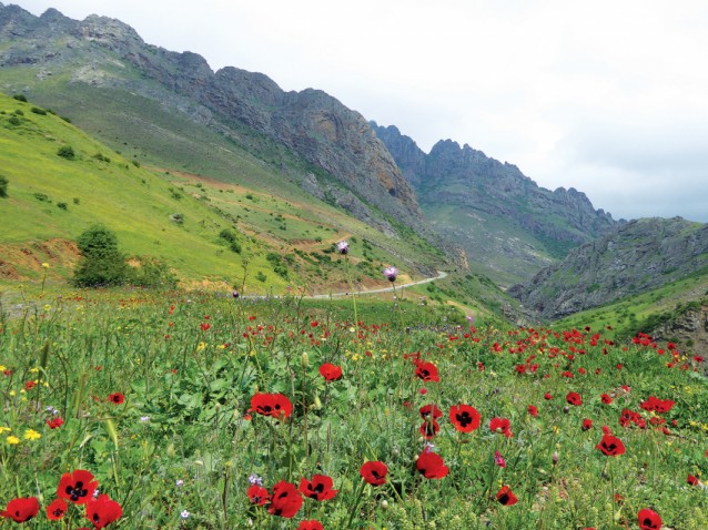 Just after Balaband the route reaches its scenic climax in rocky lipped canyons that come alive with poppies and other wild flowers in mid-May
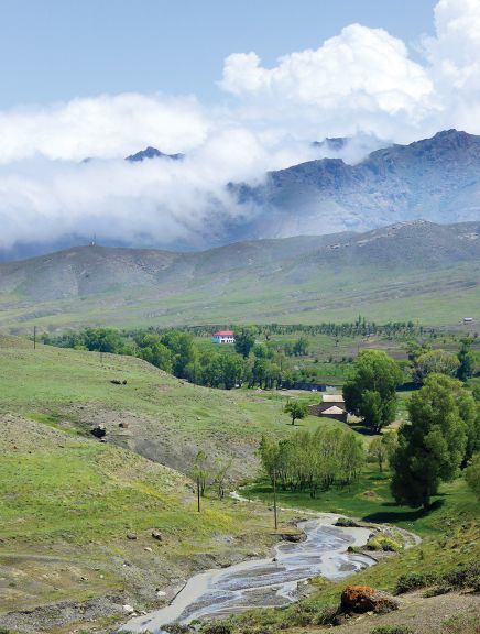
The Lenkeran-Lerik road section has long been paved and offers the widest choice of rural accommodation anywhere in the south. Now, however, good asphalt continues all the way to Kelvez, making it easy to drive on out of the cloud that so often obscures the slopes around Lerik. Scenery rapidly reaches an impressive climax around Balaband which surveys a deep rocky-edged canyon and minor peaks. Beyond is an upland agricultural area rimmed with high ridges around Kalakhan.
Backtracking to Lerik, there’s also a down-up-down side road to Shingadulan which offers a wonderfully offbeat way to see more of the agricultural valley lands of that area though there are no specific ‘sights’ here. Frustratingly the paving stops abruptly without connecting to the Yardimli or Abbasabad roads as would have seemed sensible.
| Views ***** - Great variety. Woodlands before Lerik, rocky canyons after. Accommodation & Food **** - Astonishing variety en route to Lerik, though Lerik itself has no real hotel just a homestay and backpacker rooms. Surveying the upland pastures of Kalakhan is an unexpectedly comfortable four-unit rest zone hotel (opens May-October only, tel: 050-5765666, s/d AZN70/80) attached to the Dokkuz Kardash restaurant. Another rest area resort is nearing completion in Qosmalion which is famous for its medicinal herbs. Asphalt *** - Road widening has left landslides and the surface is a little tired in places, especially on the first 20km where traffic is busier than on any of the other routes. However, once you get beyond Lerik the road is excellent and traffic almost non-existent. |
Kijoba-Sim
 This is a route to do as soon as possible as the paving seems to have been built quickly and without deep foundations so one can imagine it degrading rapidly
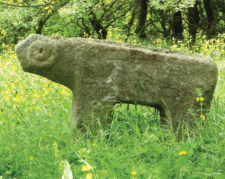
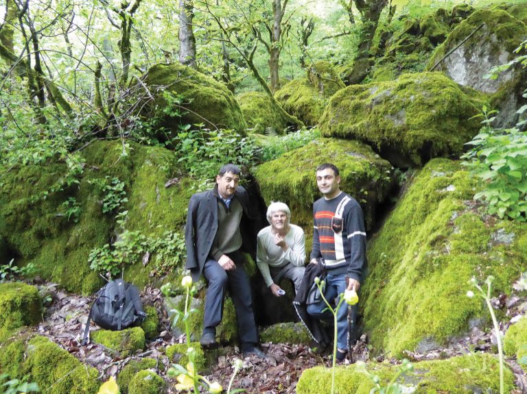
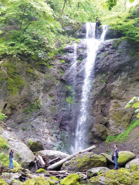
Sim is a magical village with lots of minor but fascinating hints at its history as a 7th-9th century cultural centre. Notably there’s a ‘throne’ rock at the cliff-top edge of the football pitch on which a local lord reputedly once sat to survey the wooded valley below. The village is cupped in a steep sided amphitheatre of wooded valley and sports a particularly lovely waterfall, 16m tall Ambuhuni Shalala. There are no open sweeps of view without a vigorously steep hike up to the mountaintop sheep pastures but the attractions here are visiting an ‘unknown’ village and the delight of the access road which passes through hobbit-like Hirkan forests, with tall trees well spaced on steep grassy slopes creating a feeling of a landscaped country park.
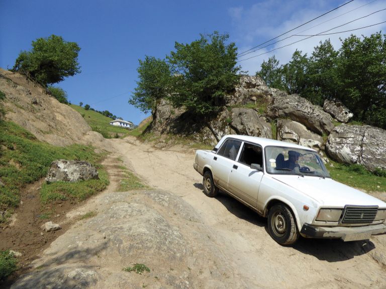
Asphalt on the relatively short road (25km off the Astara highway) stops around 2km short of the centre of Sim after which you will essentially need to walk. This is a route to do as soon as possible as the paving seems to have been built quickly and without deep foundations so one can imagine it degrading rapidly. At the bridge in Palikash (Agh Korpu) are two riverside teahouses but there are no other restaurants and the only accommodation is in people’s homes – a homestay programme is being developed by Lenkeran-based Shafaq (www.southtourism.az). It’s really aimed at local tourists who can cope with local languages (Azerbaijani and Talysh) but with a little notice Shafaq can also organise a personalised tour - Tahmina speaks English (055-392 6226). Four daily minibuses run from Astara to Palikash bridge, one continuing 4km further to the end of the asphalt 2km short of central Sim. There’s also a daily Lenkeran-Palikash minibus.
| Views **** - Woodland especially delightful in the middle section of the journey. Accommodation & Food ** - Minimal but may improve Asphalt **** - good now but won’t last! |
Pensar-Hamosham
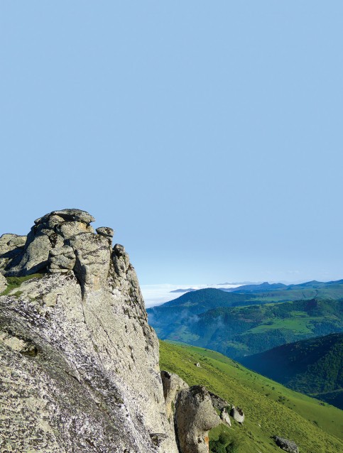 The greatest attraction is the view from Gelindaşlari (Veyüesığ), a group of rocks which is said by folklore to have been a wedding party fossilised in mid-celebration by a dragon with medusa-style powers
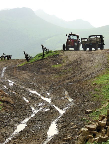
OK we’re jumping the gun with this one... As yet the 28km road from Pensar to Hamosham is a hellishly difficult mixture of slushy mud and axle-wrecking boulders. However, by 2017 asphalt is supposed to get at least that far... and possibly continue on a couple of kilometres further to Toradi, home to the locally revered Baba Rasul Pir shrine. Even when these places do become accessible you’ll still want to come by 4WD because the greatest attraction is the view from Galindashlari (Vayuasigh), a group of rocks which is said by folklore to have been a wedding party fossilised in mid-celebration by a dragon with medusa-style powers. High above the treeline the crag offers sensational panoramas, which are repeated and even bettered from Nuduz Qalasi a kilometre further.
| Views *** – Deep in lonely forests for the first half of the route, charming inhabited valleys thereafter. The really spectacular views only start after climbing above Toradi. Accommodation & Food * – There’s no formal accommodation. Tiny shops in Hamosham, one seasonal teahouse either side of Mitlayatagh. Asphalt **** – Asphalt is supposed to reach Hamosham by 2017 but even then you will need a UAZ (Russian made 4WD – Ed.) to climb the 5km from Toradi to Galindashlari. |
About the author: Mark Elliott is a veteran travel writer and author of the guidebook Azerbaijan with Excursions to Georgia, first published in 1998 and now in its fourth edition.